Accessibility
Parking
Toilets
Access Cost
Geography
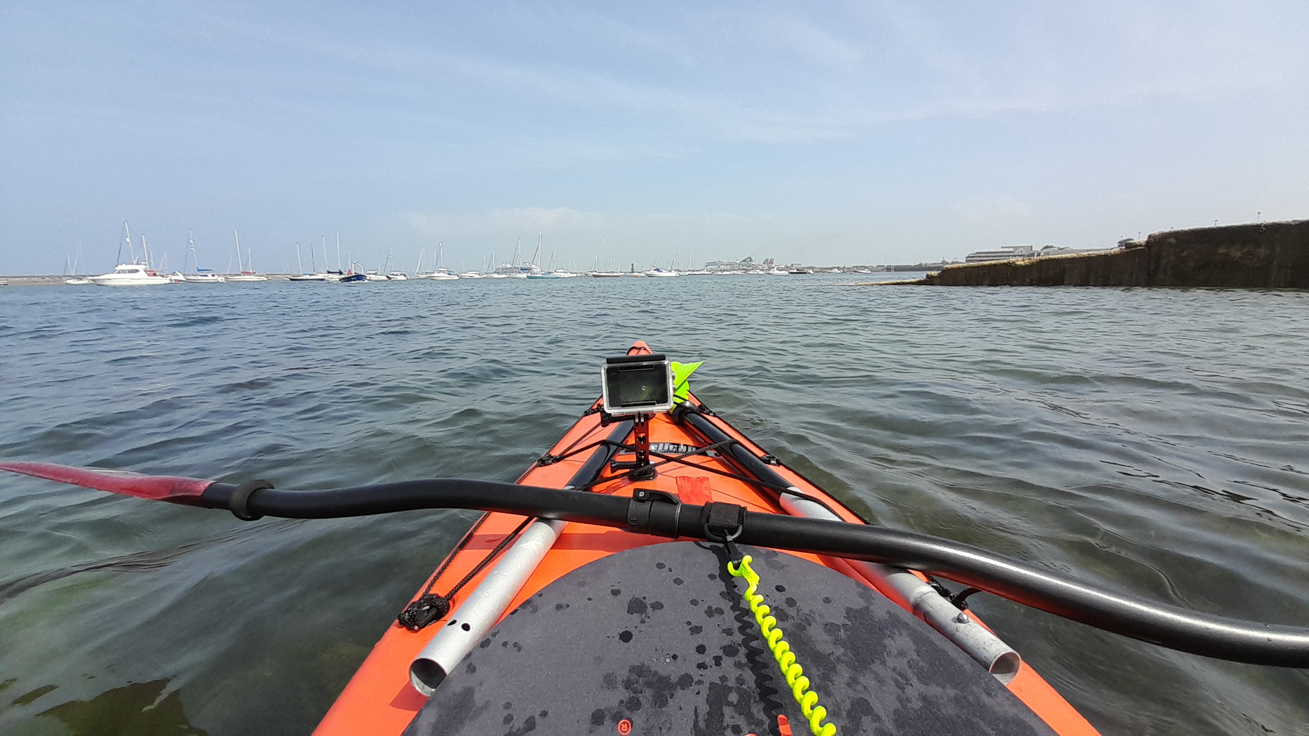
Holyhead Harbour is a working port that faces north towards the Irish Sea. The harbour is a large, partly enclosed inlet defended by substantial man-made structures. It serves ferry routes (notably to Ireland) and other maritime traffic, and spans a significant stretch along the town’s northern edge.
The harbour is protected to the north and east by the Holyhead Breakwater, the longest breakwater in the United Kingdom at around 1.7 miles (2.7 km) long. This solid stone structure runs roughly east to west, across the mouth of the harbour, sheltering its waters from the direct force of the Irish Sea. Salt Island lies immediately adjacent to the harbour’s inner reaches. Historically partly reclaimed, it forms part of the ferry terminal and port infrastructure and helps to shelter the inner harbour.
Newry Beach is a small shingle and rocky beach that sits within the outer harbour area, on the landward side of the breakwater and directly beside the town’s lower seafront. It stretches roughly east to west, backed by a promenade that runs from the Holyhead Maritime Museum on one end, past open grassy space, to near the Holyhead Sailing Club on the other.
Behind the promenade there is a grassy expanse used for walking and leisure, and parking runs alongside the adjacent road, and on the grass. The beach’s waters are relatively sheltered by the breakwater, making the area popular for water sports.
Parking & Water Access:
Parking, like everywhere, depends on the season. The best place to park is on the grass, behind the sailing club, however it’s quite steep, and it proves difficult with my wheelchair. It is a nice place to get ready, but then you will still need to transport your boats down to the slip way, so you may enter the harbour waters. You may be able to find dedicated parking spaces, both in front of the sailing club, and behind the marine offices, which are a better surface, and much closer to the slip way.
Entering the water can also be risky, so help will be needed. The slip way is steep, and when the tide is out, and can be treacherous. On top of this, the slip way is in active use. From boats being launched, and recovered, to people being taken out to their boats on the local launch, and even the RNLI who will launch their inshore lifeboat on the slipway (you will hear a siren when their pages go off).
Once you’re down, there are various gravel beaches that will serve as a pretty launch to get you into the water. We found that often, asking for help works well here. From the sailing club, to the rnli, and the marina, there are plenty of friendly people about, who’re capable of lending a hand.
Weather & Water
North Wales’ lakes are beautiful places for kayaking, canoeing, and paddle boarding. All are framed by mountains, quiet in the early morning and inviting on calm days. However, they are also inland waters that can turn quickly from tranquil to challenging when the wind picks up.
Even moderate wind over an open lake can generate chop and waves. On larger lakes with long fetch (the distance over which the wind blows uninterrupted), small breezes can grow into significant surface waves that make paddling harder, tiring and potentially unsafe, especially if you’re blown across the lake rather than along the shore.
What This Means for Your Trip:
• Always check the local weather forecast and wind warnings before setting out. A yellow wind warning from the Met Office over North Wales can mean strong and gusty conditions that affect inland waters as well as coastal areas.
• Be cautious when the breeze exceeds ~Force 3–4 (10–20 mph), as this range is where lakes tend to go from smooth to choppy and tiring. (check out our wind scale at the bottom of this page).
• Know your ability and gear. Inexperienced paddlers should stay in sheltered bays and close to shore where winds have less fetch. Advanced paddlers with experience in dynamic conditions may handle stronger wind, but should always have the skills to self-rescue, and the means to call for help if needed. Paddling with a group is also a good way to stay safe, along with making sure you have the right equipment for your adventure.
Wildlife
Holyhead Harbour and the adjacent Breakwater Country Park are rich in wildlife, featuring marine mammals like grey seals and harbour porpoises, alongside diverse birdlife including rare chough, black guillemots, and peregrine falcons. The area’s rugged cliffs and coastal scrub provide habitats for reptiles, coastal birds, and unique flora.
Grey seals frequently bask on the rocks near the harbour and breakwater, with pups appearing in autumn. Both Bottlenose and Risso’s dolphins are spotted in the area, particularly towards the end of summer. The rocky coast is home to sea anemones, sponges, and various crustaceans, not to mention the various jelly fish, star fish, varieties of shark, and octopus you can find just in the harbour.
Black Guillemots are frequently spotted near the fish quay, along with European Shags, Cormorants, and Herring Gulls. Peregrine falcons and Little Owls can be seen hunting in the vicinity of the Breakwater Country Park.
Pollution
The pollution level of Holyhead Harbour / Newry Beach can be checked on Dŵr Cymru’s Storm Overflow map.
Mythology
The Irish Giant, Sirigi: Following the Roman era, the Welsh warrior Caswallon is said to have defeated the Irish giant Sirigi in the area. While constructing the breakwater in 1864, workers discovered the teeth and jawbone of a woolly mammoth in the mud. Associated with folklore, this site is sometimes known as the Well of the Hag, adding to the mystical atmosphere of the area.
Wind Speed Guide for Recreational Paddlers
| Wind Strength | Typical Conditions on Lakes | Notes |
|---|---|---|
| < ~10 mph Beaufort Scale 0-2 | Calm water, small ripples only | Generally safe and pleasant for most skill levels. |
| ~10–15 mph Beaufort Scale 3 | Larger wavelets and breaking crests | Novice paddlers may find conditions tiring; wind against your course increases effort. |
| ~15–20 mph Beaufort Scale 4-5 | Small to moderate waves | Conditions can become challenging or unsafe for less experienced paddlers. |
| 20 mph+ Beaufort Scale 5+ | Rough water, frequent white caps (White horses) | Not recommended for recreational kayaking or paddle boarding — risk of capsize or being blown off course. |
Discover more from Baileys Int' Wild
Subscribe to get the latest posts sent to your email.